Download
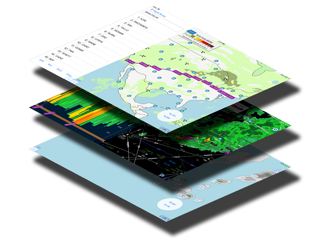
Maintenance Alert
Global Composite Turbulence Guidance is under maintance until Feb 22nd. NWS CONUS Turbulence is displayed in the meantime
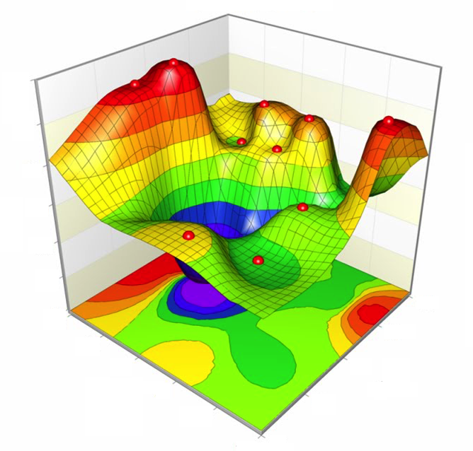
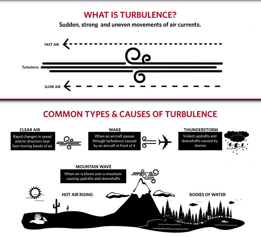
4D Clear Air Tubulence forecast measured in ICAO standard's Eddy Dissipation Rate
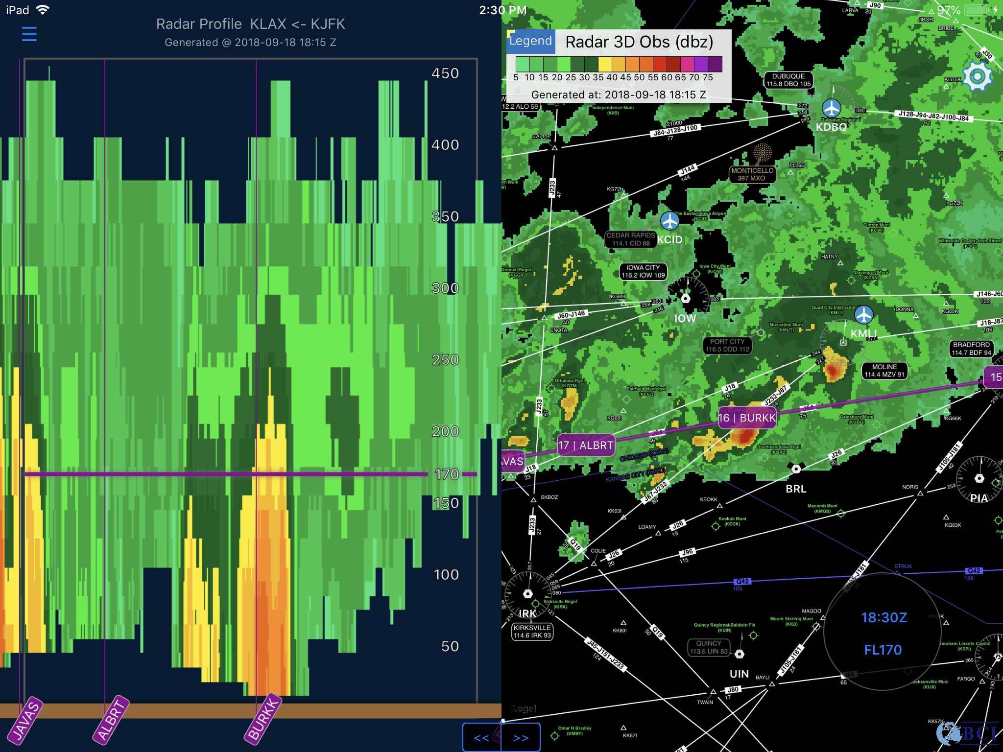
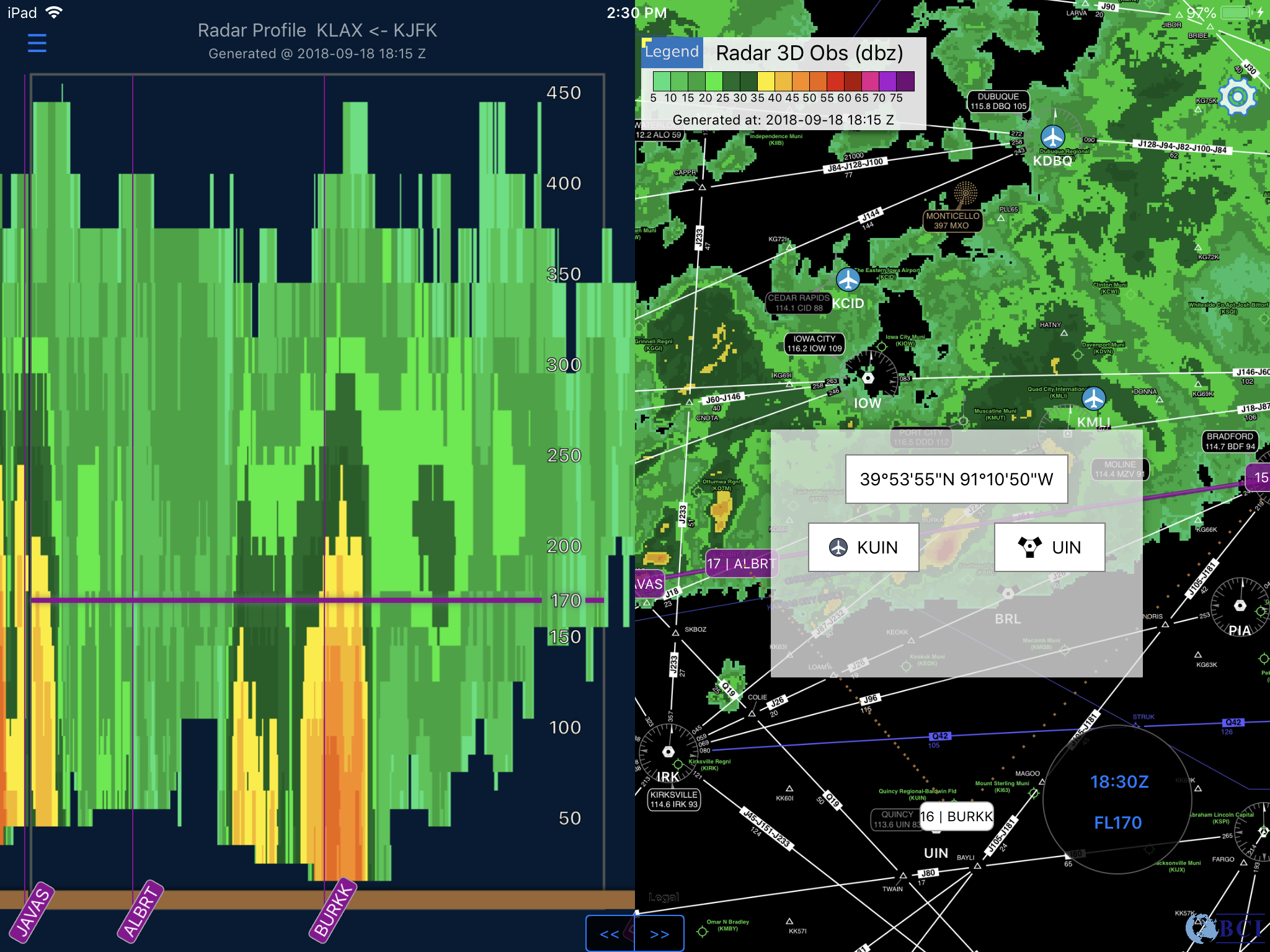
CONUS 4D reflectivity mosaic based on Multi-Radar Multi-Sensor research at NCAR
Advanced weather product that characterize cloud structure and intensity
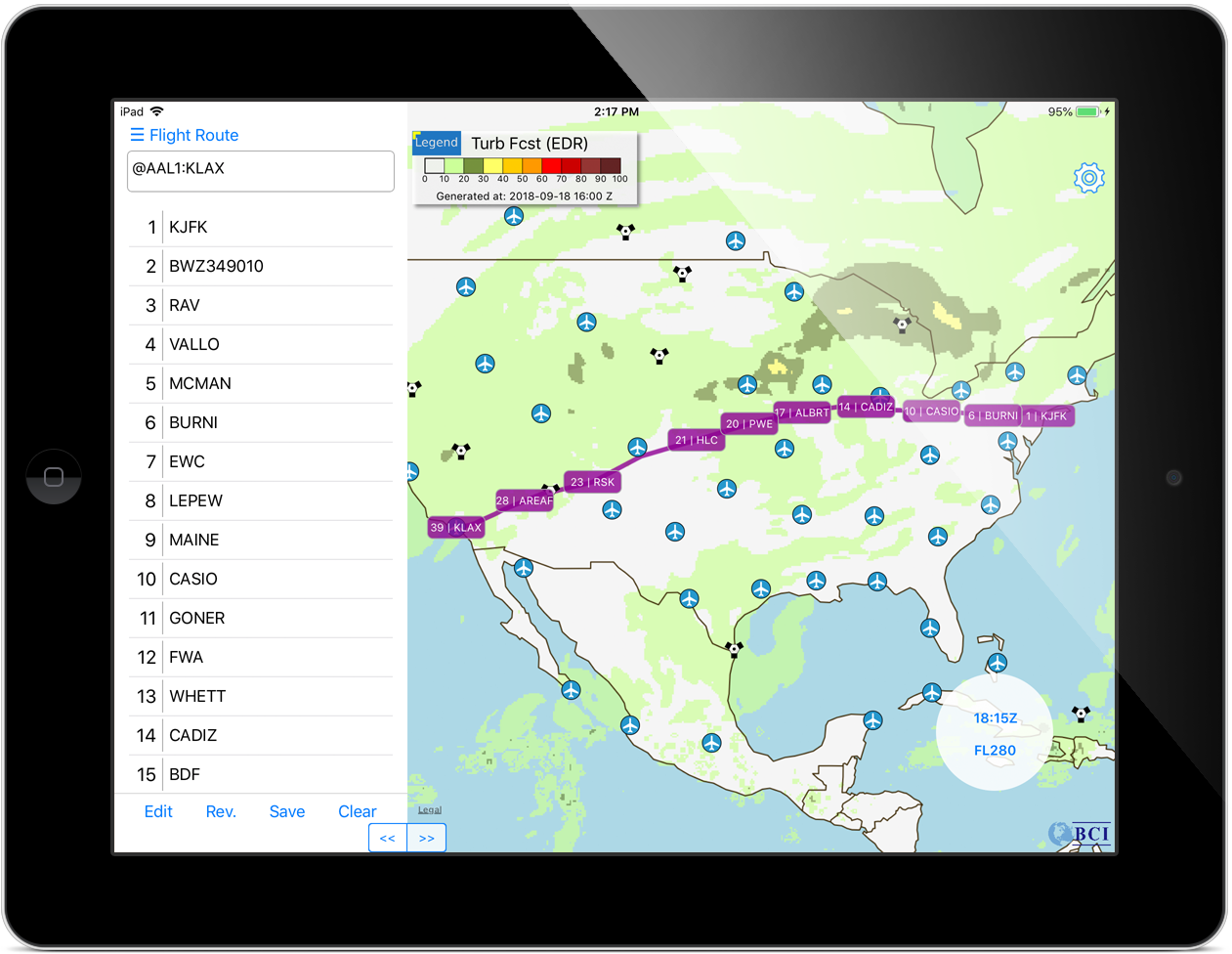
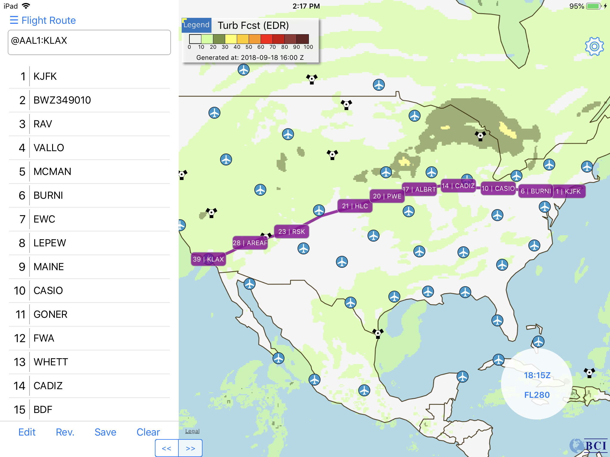
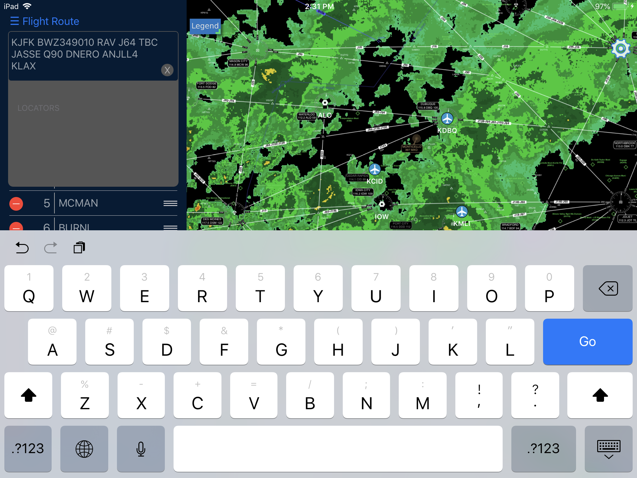
Retrieve submitted flight plan, or plot route via map and/or text input
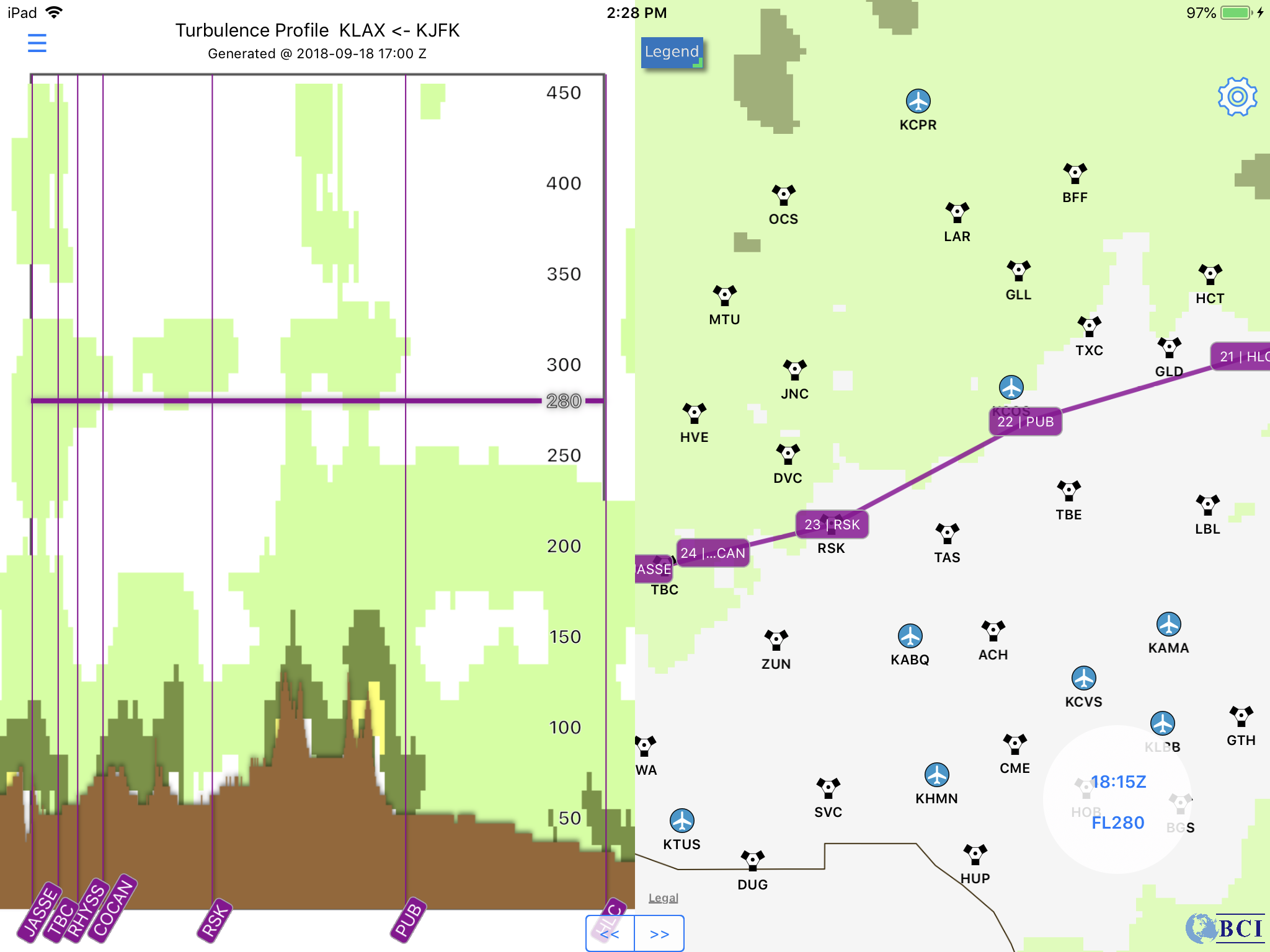
Browse weather products in vertical representation along flight path and measure impacting distance
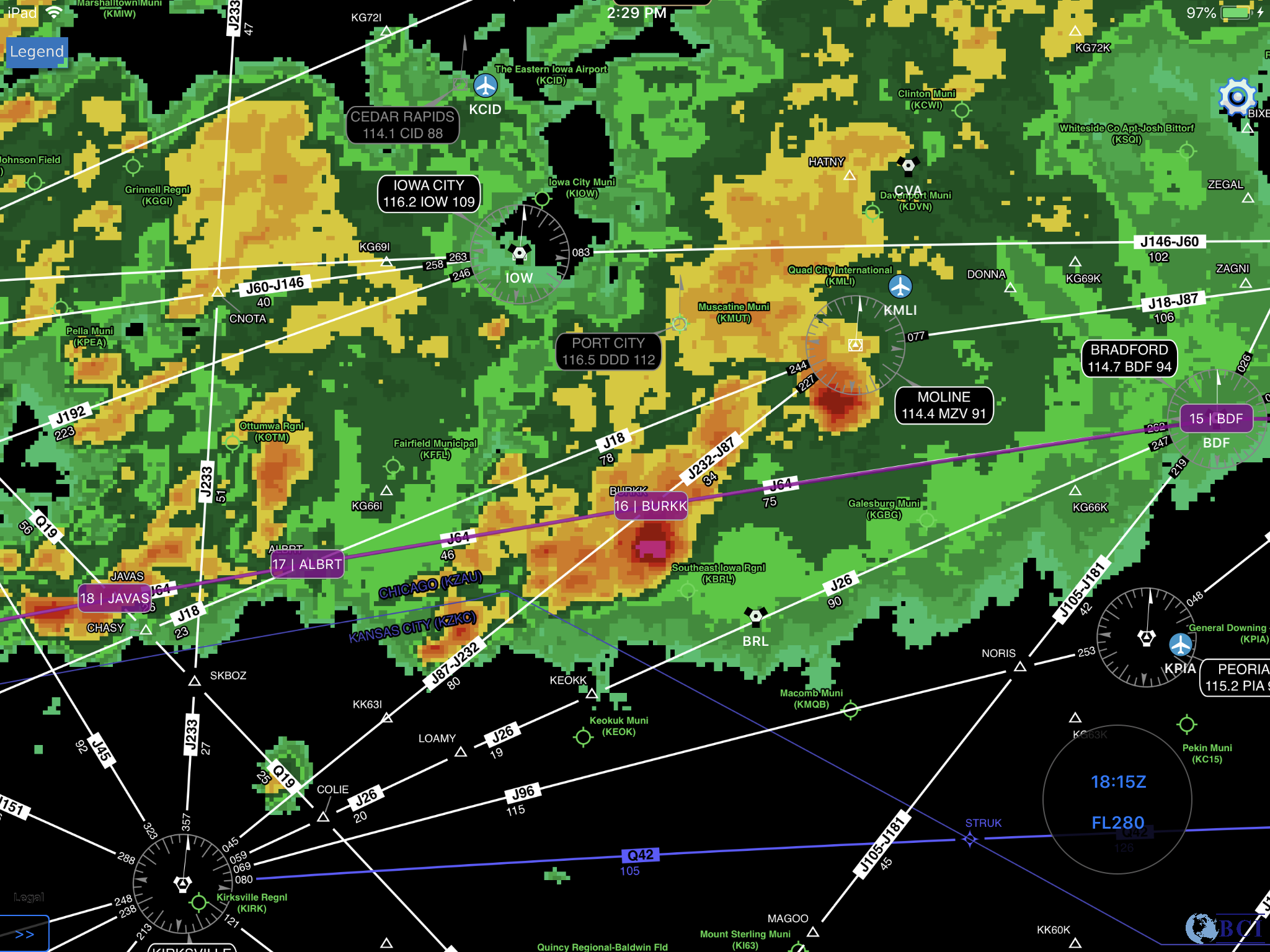
Integrated SkyVector IFR Enroute High and Low chart, and IFR Area chart
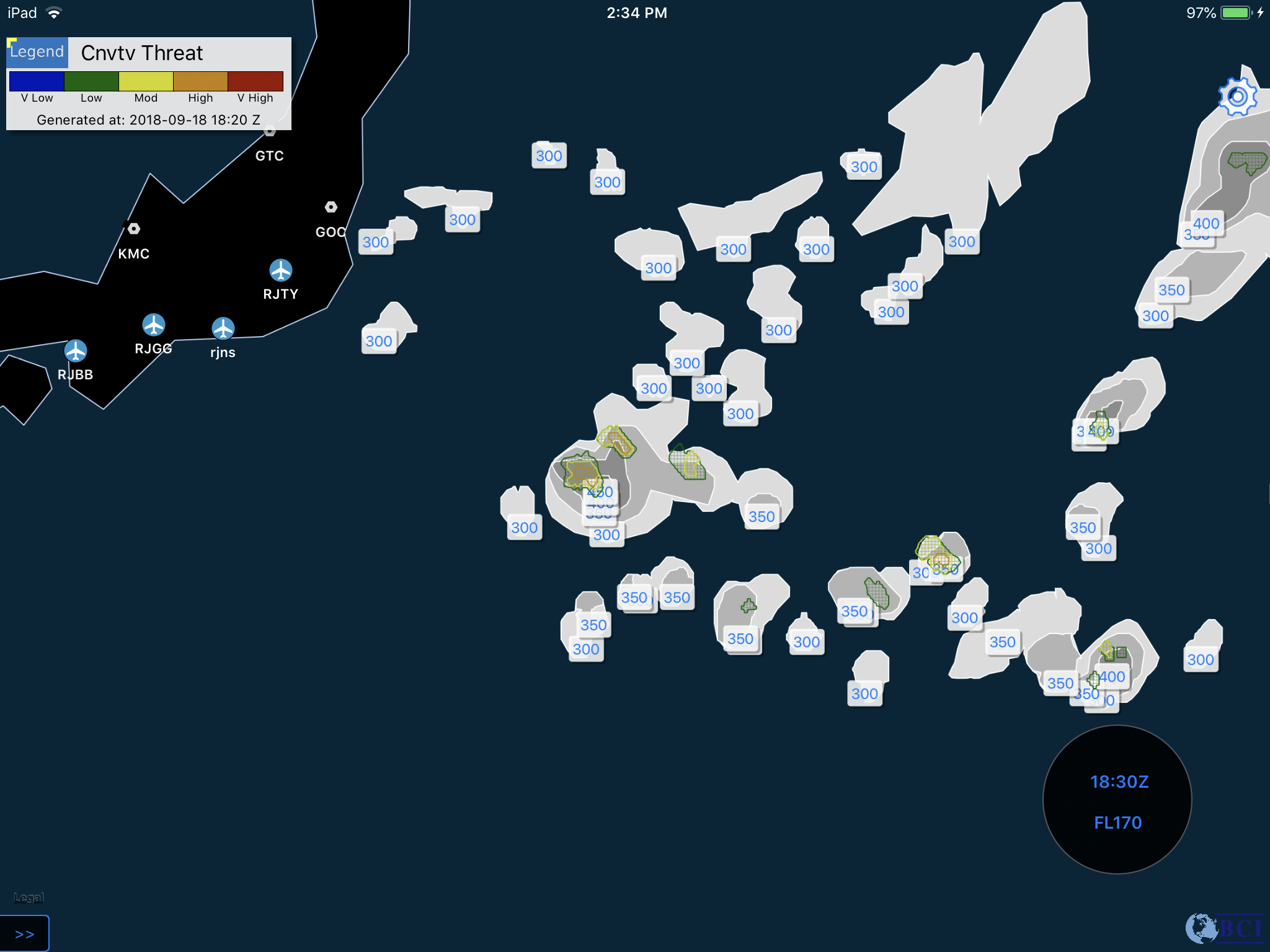
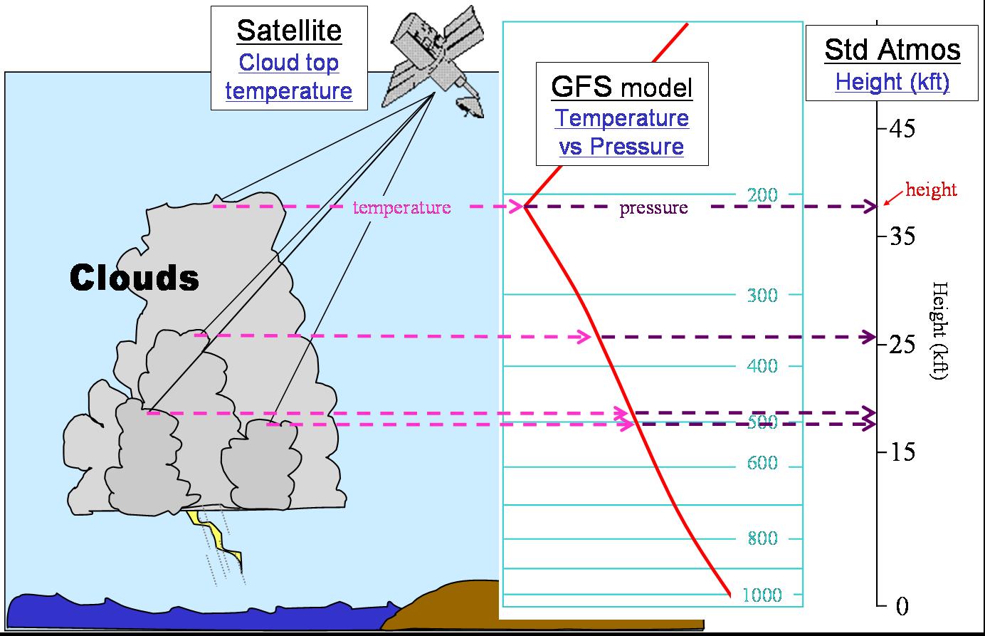
Using both Cloud Top Height (Cloud Top) and Convection Diagnosis Oceanic (Convective Threat) products together, users can quickly locate hazardous region worldwide. The Cloud Top product depicts the cloud top in flight level by utilizing geostationary satellites with GFS model. The Convection Diagnosis Oceanic detects convective regions by computing with a weighted combination of inputs derived from satellite-based detection algorithms and global lightning strikes.
NCAR Oceanic Remote Weather /
ATCA Journal NCAR EFB
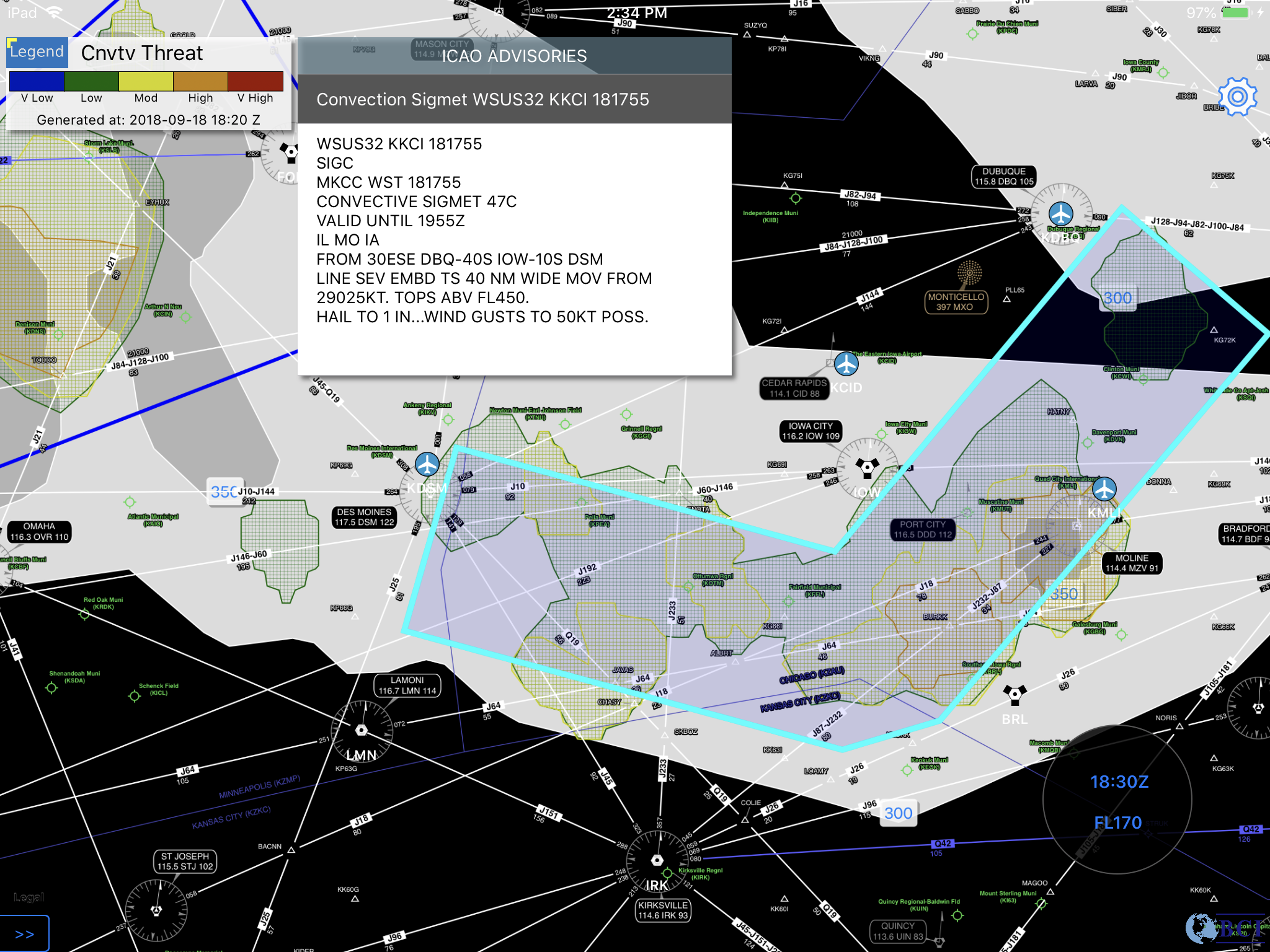
According to NASA's Aviation Safety Program, weather is a contributing factor in about 30 percent of all aviation accidents. Turbulence is the greatest cause of airline injuries which can costs airlines over $100 million a year. Global Composite Turbulence Guidance product uses advanced algorithm from MeteoStar with turbulence forecast from NWS to help users to identify hazardous regions and improve the passengers and crew safety.
App Avoid Turbulence / Delta Talks Turbulence
By utilizing top down view and vertical profile view of the weather, our unique vertical weather profile can improve the situational awareness along your flight route